Max Wilbert, Susan Hyatt, Katie Wilson, and Michael Carter, Deep Green Resistance Southwest Coalition
In late May 2014, members of Deep Green Resistance (DGR), Great Basin Water Network, the Ely-Shoshone Indian tribe, and others toured the valleys of eastern Nevada and western Utah targeted by the Southern Nevada Water Authority (SNWA) for groundwater extraction.[1] The region is part of the Great Basin, a cold desert named for its lack of any drainage to an ocean. What rain falls in the Great Basin remains there in a few streams, ponds, lakes, springs, and aquifers. It is these aquifers that SNWA wants to pump into a central pipeline and bring to the cities of Las Vegas and Henderson. The Goshute and Shoshone tribes and many groups, local individuals, businesses, and governments oppose the project, now stalled by lawsuits. DGR initiated the Sacred Water Tour to help familiarize potential opponents with the land and the water conflict.
We met on the 24th at the Goshute Tribal Headquarters, in the tiny town of Ibapah, Utah, near the Nevada border. More than a year earlier, DGR coordinators Max Wilbert and Michael Carter met the tribal council here for the first time, to offer solidarity and assistance with the water-grab fight.

Goshute Tribal Headquarters
It was the Goshute’s dilemma that first attracted our attention to the SNWA pipeline.[2] Both the Goshute and Ely Shoshone (the Shoshone in this region called themselves “Newe”) have reservation land in the affected area, and both have been fighting the pipeline since it was first proposed. Rick Spilsbury, a Shoshone man from Ely, Nevada, led the tour, which began with Spring Creek, near Ibapah in Antelope Valley.
Spring Creek sustains a rich diversity of life. Rare Bonneville cutthroat trout swim in the creek and reservoir, elk come to drink, and many medicinal and edible plants grow in the riparian areas. Watercress lines the creek, and stinging nettles and wild rhubarb grow under the shade of the rocks where the water emerges. The stewardship of the Goshute has been integral in the return of Bonneville cutthroat to their native waters, and Spring Creek is essential in the restoration of the native fish population.[3]
About a dozen Goshute people went along this part of the tour, including young children transfixed by the sight of water springing straight from rock. The small stream cooled a channel through hot, dry air. The Goshute seemed especially quiet here, though all laughed when one of us held up a handful of old elk droppings, apparently thinking we didn’t know what they were. There seemed a lightness of heart to the mood, maybe because all felt that for the time being, the spring was safe.

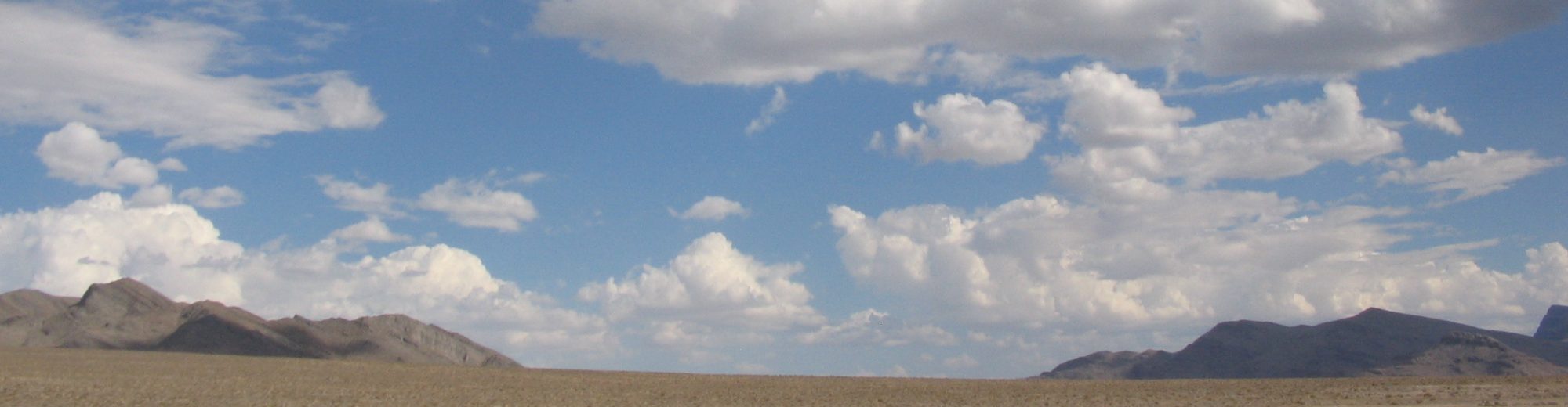
Pond at Spring Creek and Deep Creek Range
SNWA suffered a major legal setback in December, 2013, when a Nevada District Court judge ruled that the State Engineer’s decision allowing the groundwater pumping was “arbitrary and capricious,” and also “criticized the proposed plan to monitor and take action if damage to the environment occurs and stated there must be scientific triggers.”[4] “Triggers” are events—such as the drying of springs or wells—that would force SNWA to cease pumping water and re-evaluate how it’s impacting an aquifer.
Before this ruling, SNWA wouldn’t even negotiate the possibility of triggers, according to tour guide Rick Spilsbury. Though SNWA has appealed, and other federal lawsuits against the project are pending, the overall outlook for now is good. As Spilsbury explained it, SNWA owns the water rights but because they’re locked in litigation, the water must legally stay put. However, he also cautioned that in the midst of this wave of good news is the bad news that weary pipeline opponents are becoming complacent.
It is important to remember that no success is guaranteed to last as long as industrial civilization stands. And any loss will be effectively permanent. Overdrawn aquifers will not return to their original states on timescales meaningful to humans. It’s possible to stop the SNWA pipeline, but if organized action doesn’t materialize before it’s too late, the effects are irreversible.
“My people have lived here sustainably for over 10,000 years,” said Spilsbury. “We want that for all of the Earth for another 10,000 years.”
From Spring Creek, the tour proceeded south through Antelope Valley into Spring Valley. Spring Valley would be mined for 61,127 acre feet of water annually (one acre-foot is enough water to cover an acre of land a foot deep—about 325,850 US gallons). Along with other valleys targeted for wells—Delamar, Cave, and Dry Lake—the project may produce 200,000 acre feet of water per year.
That night, we stopped to camp at Cleve Creek on the eastern edge of Spring Valley. We did not see any of the “Indian Petroglyphs” indicated on the map, but the place’s coolness, its cottonwoods and willows, its little gurgling creek, the distant tree-spotted meadows in the Schell Creek Range above, all spoke of its endurance and durability. The vestigial ice-age water below the surface—not so long ago, these valleys were long fjords of inland seas, the many mountain ranges slender peninsulas and islands—had a quiet language of its own, too. This quiet of the Great Basin is immense, sometimes intimidating. At Cleve Creek that night, as small thunderstorms came and went and birds and bats circled in the twilight, the calm was overwhelmingly of peace and security.
The conversation turned to the topic of bears and, as if the sky were participating, the clouds parted to reveal the constellation Ursa Major (the Great Bear), whose seven brightest stars are also known as the Big Dipper.
The next day we went further south through Spring Valley to the Swamp Cedars, a place that is both sacred and horrible to Goshute and Shoshone peoples. For many generations, this was a gathering place, trading ground, and ceremonial area. But only two generations ago, Mormon settlers and the U.S. cavalry attacked Newe gathered at this location.[5] Over a hundred people were killed in three massacres.

Sacred Water Tour, 2014
After paying our respects, admiring the rare ecology of a valley-floor forest in Nevada, and contemplating the sobering fact that this site is surrounded by SNWA test wells and is constantly threatened (a nearby wind farm was originally sited in the cedars), we proceeded further south.
After passing through Ely for resupply, long dirt roads carried us further south in sagebrush valleys between several mountainous wilderness areas (including Mount Grafton Wilderness). These remote, life-filled areas are threatened by the water grab as well.
In the heat of the afternoon, we dropped down to the West to Hot Creek Springs and Marsh Area, part of Kirch Wildlife Management Area. We visited Adams-McGill Reservoir, an oasis full of fish, flanked by many birds and lined with thick bulrush. A great blue heron waited nearby to show us that life can thrive in the desert—if there is water.

Kirch Wildlife Management Area
The endangered White River spinedace live in these waters, and are directly threatened by the proposed pipeline which would drain crucial habitat for the few remaining spinedace populations.
According to the Center for Biological Diversity, “A recent environmental impact statement for the proposed pipeline project disclosed that major vegetation and ecosystem changes would occur on more than 200,000 acres, including wetlands that will dry up and wildlife shrubland habitat converted to dryland grasses and noxious weeds. More than 300 springs would also be hurt, along with more than 120 miles of streams.”[6]
We headed back into Cave Valley via an extremely rough road, and we guessed that it rarely travelled. No place to break down. Even though the herd of wild horses we glimpsed knew where to find water out in these dry open valleys, there is no guarantee we could find drinking water. There are few perennial streams or springs. Most of the water is held in the ground, and the shallow groundwater brings life. Every drop of water counts. Water stolen means death to many of those who call this land home.
As the Goshute put it, “even a slight reduction in the water table will result in a cascade of wildlife and vegetation impacts directly harming our ability to engage in traditional practices of hunting, gathering, and fishing on ancestral lands. As our former Chairman Rupert Steele has pointed out; ‘if we lose our language or our lands, we will cease to be Goshute people.’ SNWA’s groundwater development application is the biggest threat to the Goshute way of life since European settlers first arrived on Goshute lands more than 150 years ago.”[7]
Before reaching our next camp in a small pass along the side of Cave Valley, we passed beneath the great tilted limestone peaks of the Schell Creek mountain range.

Schell Creek Mountains
Our campsite that evening, with views into two valleys threatened by SNWA, reminded us of what happened to the Owens River Valley in California after a water extraction project. The valley was turned into a desiccated, dusty landscape largely devoid of life.[8]
That evening, we watched the sunset—a vibrant backdrop of rust, fuschia, and vermillion—from a remote limestone bluff above the pass until the light faded and hunger and darkness drove us back to camp.

Great Basin sunset, Cave Valley
The sun rose bright on our final morning, cicada song rising in volume with the light. We drove east along several more valleys before dropping into Lake Valley, where SNWA has purchased several ranches. The largest ranch was scandalized when SNWA fired a ranch manager for sexually harassing a female employee. According to Spilsbury, the money-losing ranch is an unpopular venture for the semi-public water agency, even in Las Vegas.
The day was warming quickly, reminding us this desert isn’t always cold. Lake is a broader valley than the others, the mountain ranges lower and gentler than those just to the west. Here the distance felt lonelier, more desolate, yet grazing antelope and circling ravens made their ways through the heat and bright sun. We made a final stop at another SNWA test well, and found beetles and ants and many other subtle crawling things in the cow-burnt soil. A sign in the bulldozed perimeter read “restoration area” with no evident irony at all. We said goodbye, wondering what would happen next, what we could do. The fate of this land seems in the hands of lawyers and judges, where a city’s agents have squared off against the scattered peoples of the dry valleys who only seem to want to be left alone. This is the old weary story of civilization—of legitimized theft, of an inevitable trajectory of civilized human endeavor that always ends in ruin. Yet the land wants to live.

SNWA Test Well site, Cave Valley
As long as the cities of civilization exist near these wild places of sage and sky, they will have their eyes on the water. Even with precious little water evident in the landscape and ecology of the dry valleys, the judge in the December court ruling has noted that the SNWA water-grab is “likely the largest interbasin transfer of water in U.S. history”.[9] If the pipeline is approved the beautiful land will be permanently transformed into a dry dead place in the same way that other lands have been destroyed by this culture of extraction. As Derrick Jensen says, “Civilization is not redeemable. This culture will not undergo any sort of voluntary transformation to a sane and sustainable way of living. If we do not put a halt to it, civilization will continue to immiserate the vast majority of humans and to degrade the planet until it (civilization, and probably the planet) collapses. The effects of this degradation will continue to harm humans and nonhumans for a very long time.”[10]
DGR Southwest Coalition is searching for strategies to add defenses to the water and communities of the region. One possibility is being advanced by Community Environmental Legal Defense Fund, which “works with communities to establish Community Rights—such that communities are empowered to protect the health, safety, and welfare of their residents and the natural environment, and establish environmental and economic sustainability.”[11] We welcome any suggestions and offers to help; we also encourage you to join the yearly Sacred Water Tour next May.
[1] Michael Carter, “Groundwater Pipeline Threatens Great Basin Desert, Indigenous Groups,” Deep Green Resistance News Service, June 17, 2013, http://dgrnewsservice.org/2013/06/17/groundwater-pipeline-threatens-great-basin-desert-indigenous-groups/
[2] Stephen Dark, “Last Stand: Goshutes battle to save their sacred water,” Salt Lake City Weekly, May 9, 2012, http://www.cityweekly.net/utah/article-35-15894-last-stand.html?current_page=all
[3] US Fish and Wildlife Service, “Status Review for Bonneville Cutthroat Trout,” October 2001, http://wildlife.utah.gov/cutthroat/BCT/literature/fws/bct_status_review.pdf
[4] Lukas Eggen, “Opponents of SNWA pipeline earn ‘complete victory’,” The Ely Times, December 13, 2013, http://www.elynews.com/2013/12/13/opponents-snwa-pipeline-earn-complete-victory-2/
[5] Delaine Spilsbury, “Clark, Lincoln, and White Pine Counties Groundwater Development Project Public Comment,” October 5, 2011, http://water.nv.gov/hearings/past/springetal/browseabledocs/Public Comments/Delaine Spilsbury 3.pdf
[6] Center for Biological Diversity, “Top 10 U.S. Endangered Species Threatened by Overpopulation,” October 28, 2011, http://www.biologicaldiversity.org/news/press_releases/2011/7-billion-10-28-2011.html
[7] Protect Goshute Water, “Southern Nevada Water Authority Groundwater Pumping & Pipeline Proposal,” The Confederated Tribes of the Goshute Reservation, accessed June 24, 2014, www.GoshuteWater.org
[8] Marc Reisner, Cadillac Desert. New York: Viking Penguin, 1986.
[9] Rob Mrowka, “Lawsuit Filed to Halt Massive Las Vegas Water Grab: Pipeline Would Dry Up Springs and Wetlands, Hurt Fish, Sage Grouse, Pronghorn and Other Species” Center for Biological Diversity, February 12, 2014http://www.biologicaldiversity.org/news/press_releases/2014/southern-nevada-water-authority-02-12-2014.html
[10] Derrick Jensen, Endgame (Volume I): The Problem of Civilization. New York: Seven Stories, 2006.
[11] Community Environmental Legal Defense Fund, “Community Rights,” accessed June 25, 2014, http://www.celdf.org/section.php?id=423